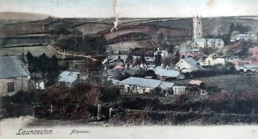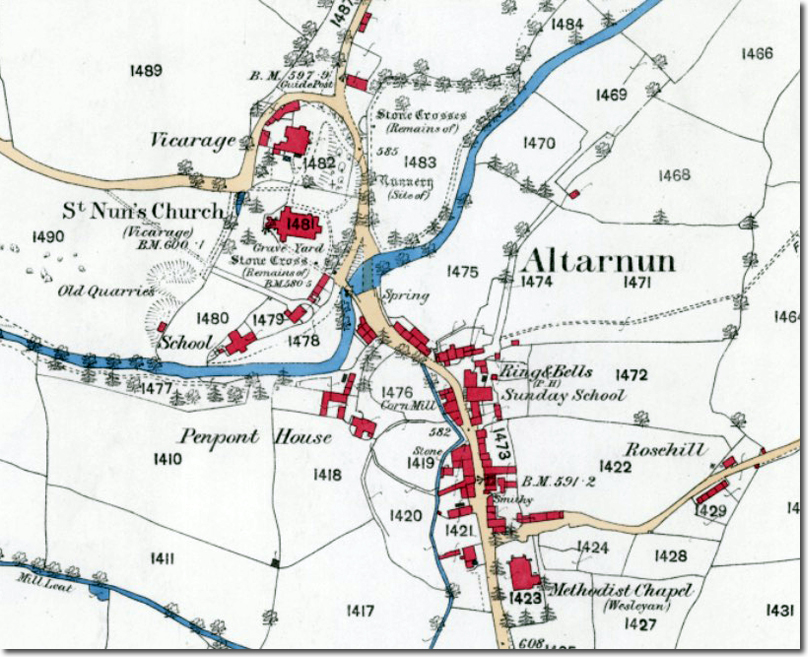
Altarnun village, lying in the sheltered valley of the Penpont Water on the eastern edge of Bodmin Moor, has long been regarded as one of the most attractive and historically complete settlements in Cornwall. The Victorian map of the parish shows a compact moorland community arranged around its church, its mill and its leat, with a scattering of farms and manor houses forming a wider ring around the village core. Before the First World War the pattern of life in Altarnun had changed little for generations, and the map captures a parish still shaped by agriculture, water power and the long-established routes across the moor.
The centre of the village was dominated by St Nonna’s Church, often called the “Cathedral of the Moors” for its size and its tall granite tower. The churchyard, the bridge and the mill formed a natural grouping, with the leat running through the village to feed the mill wheel. The Victorian map shows the leat clearly, threading its way past cottages and gardens before reaching the mill buildings. The mill was an essential part of village life, grinding local grain and serving the surrounding farms. Its position beside the bridge made it a focal point for movement through the village, and the sound of the wheel would have been a familiar one well into the nineteenth century.
Altarnun’s houses and cottages were arranged along the lanes leading to the church, many of them built of local granite with slate roofs and small, irregular windows. The Victorian map marks several larger houses and small manor farms, reminders that the parish once supported a number of modest gentry families and prosperous yeoman farmers. These included properties such as Trewint, Penpont, Trebullom and Bowithick, each with its own long history and its own relationship with the moor. The farms were mixed holdings, with cattle, sheep and small arable fields enclosed by granite walls and earth banks. The moor itself provided rough grazing, peat and turf, and a sense of openness that shaped the character of the parish.
The lanes shown on the Victorian map reveal a pattern of movement that had existed for centuries. The road from Launceston crossed the moor towards Bodmin, passing Jamaica Inn and entering Altarnun parish before descending into the village. Other lanes linked the outlying farms to the church and the mill, reflecting the central role of the village in parish life. Before the coming of the motor car, these routes were used by packhorses, carts and farm wagons, and the distances between farms and village were measured in the time it took to walk them.
Altarnun’s economy before the First World War was almost entirely agricultural. The parish supported blacksmiths, carpenters, masons and other rural trades, but farming was the foundation of local life. The Victorian map shows the pattern of fields, orchards and meadows that surrounded the village, and many of these boundaries remain visible today. The moorland climate, with its high rainfall and cool summers, favoured livestock over arable crops, and sheep and cattle were the mainstay of the parish. The annual rhythms of lambing, haymaking and market days shaped the lives of the villagers.
The social life of Altarnun centred on the church, the school and the inns. The church was the spiritual and communal heart of the parish, hosting services, festivals and gatherings. The school, built in the nineteenth century, provided education for the children of the village and the surrounding farms. The inns and alehouses offered meeting places for travellers and locals alike. The Victorian map marks several such establishments, reflecting the parish’s position on the moorland routes between Launceston, Bodmin and the coast.
By the time of the First World War, Altarnun remained recognisably the same village shown on the Victorian map. The mill still operated, the leat still ran through the village, and the farms continued to work the land much as they had for generations. The war brought change, as it did everywhere, but the essential character of Altarnun endured. The village retained its pattern of lanes, cottages and farmsteads, its relationship with the moor and its sense of continuity with the past. The Victorian map captures this moment in the parish’s history, showing a community shaped by its landscape, its watercourses and its long-established ways of life.