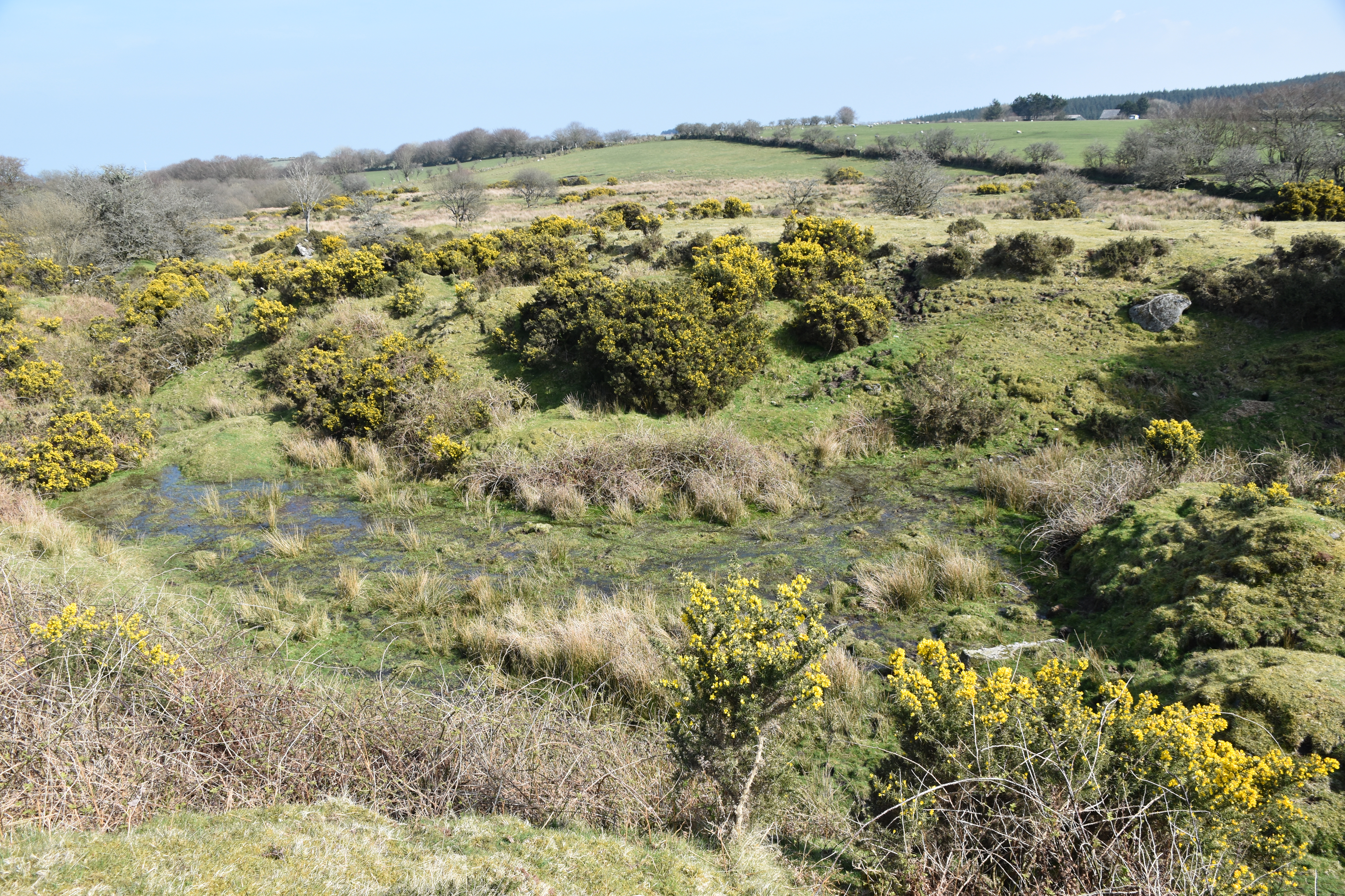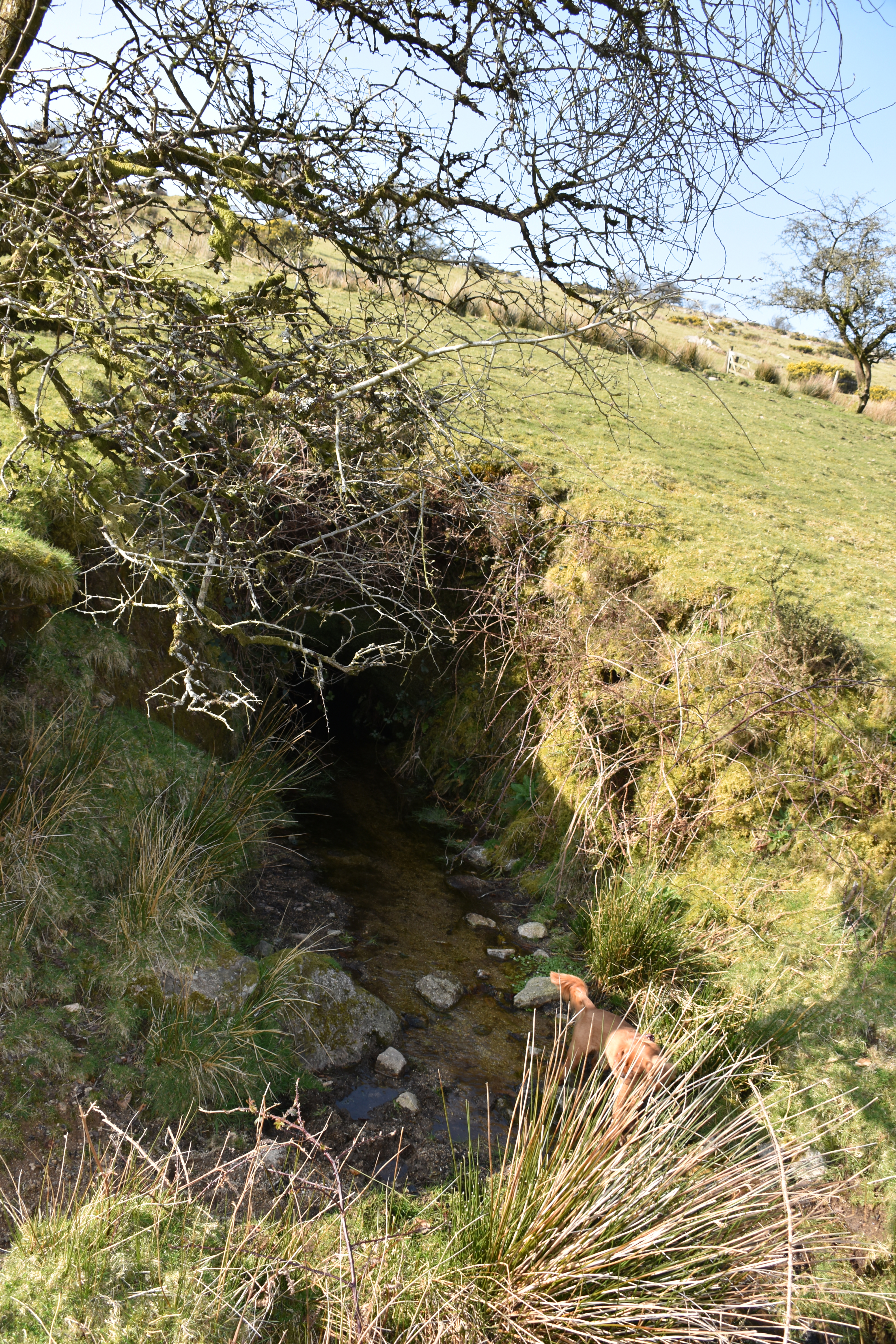
The River Lynher rises on the eastern flank of Bodmin Moor, in a landscape of rough grass, peat, granite outcrops and scattered prehistoric remains. Its headwaters form in the shallow hollows beneath The Beacon on Hendra Down, where numerous small springs and seepages gather into a single channel. From here the young river flows eastwards, cutting through moorland turf before turning south towards the wooded valleys of the middle Lynher. This upland area is one of the most sensitive parts of the catchment, where the river is at its narrowest, cleanest and most vulnerable to disturbance.
The geology of the source area is typical of Bodmin Moor: granite overlain by thin soils, with pockets of peat and marsh where water accumulates. Rainfall is high, and the ground remains saturated for much of the year. The river begins almost imperceptibly, emerging from beneath tussocks of moor‑grass and heather, before forming a defined channel that descends towards the medieval tin‑streaming grounds below (see photo below). These early reaches are ecologically important, supporting mosses, sedges and invertebrates adapted to cold, oxygen‑rich water.
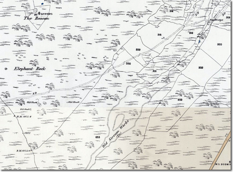
Human activity has shaped the upper Lynher for centuries. Medieval stream‑tin workings lie directly below the source, where miners diverted water to scour the valley sides and wash tin‑bearing gravels. This form of alluvial mining — essentially controlled erosion — left a distinctive pattern of channels, spoil heaps and artificial terraces. The process was efficient but destructive, stripping vegetation and mobilising large quantities of sediment. Such activity would have increased turbidity and altered the river’s natural course, effects that can still be traced in the landscape today.
Later mining added further pressure. Small tin and wolfram trials on the eastern edge of Bodmin Moor introduced metal‑rich waste into the catchment, and although the workings were modest compared with the great mines of west Cornwall, even limited contamination had an impact on a river as small as the upper Lynher. Heavy metals from crushed ore and spoil heaps would have washed into the watercourse during periods of heavy rain, affecting water quality downstream. The headwaters, being narrow and slow to recover, were particularly vulnerable.
Despite this history, the source of the Lynher remains one of the most unspoilt parts of the catchment. The river’s early course across Hendra Down retains a sense of isolation, with skylarks overhead and the moor stretching away towards Rough Tor and Brown Willy. The stream gathers strength as it leaves the uplands, flowing past the medieval tin‑streaming grounds and into the wooded valleys that characterise the middle reaches. From here it continues southwards towards St Germans, where it broadens into a tidal estuary before entering the Tamar.
The source of the River Lynher is therefore both a natural and historical feature: a quiet moorland spring shaped by geology, climate and centuries of human use. Its waters have carried the legacy of medieval tin‑streaming, later mining and agricultural change, yet the headwaters still retain the clarity and character of a Bodmin Moor river beginning its journey to the sea.